OLEX 11.5
Norwegian based OLEX AS, the manufacturer of complete systems for navigation, plotting and 3D seafloor mapping, is pleased to announce that OLEX 11.5 is now released and available as a free download or through your local Olex dealer for an upgrade of your system.
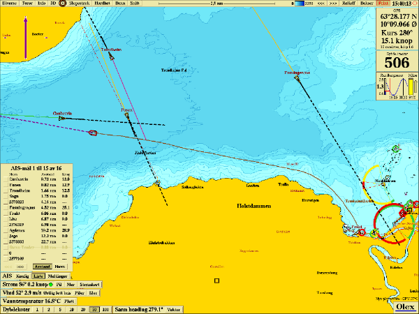
This latest series of software upgrades includes a lot of new and advanced tasks, and as always there will be more to come. Some of these new tasks allow improved ATEC multi beam operation as well as AIS target data handling. Moreover enhanced vector chart presentation, system ergonomics and upgraded support of Scientific Linux are also included. A more detailed list of these new features available in OLEX 11.5 software version are:
- Still more improved reporting of fishing gear
- Wider CPA warning against AIS targets
- New demo for Koden CVF-FX2
- New function to inspect tides anywhere
- More names on vector charts
- Improved reporting of fishing gear
- Fixed nuisance corruption of Atec-400
- Adjusted hardness values again from Kaijo KSE-300, to be from -50 to -10
- Free Norwegian charts, “Norgeskart”, always included
- Adjusted hardness values from Kaijo KSE-300
- Upgraded NMG charts from NGU
- Curl upgraded for all supported versions of Scientific Linux
- With Berner function, to make plotter objects more visible
- Always shows CPA for AIS targets, to help trawlers
- Modified position format in fishing gear report emails
- New system for reporting fishing gear over email
- New free Norwegian charts, “Norgeskart”
- Better support for Atec-200
- Internet access always displayed
- Better Atec-200 performance through automatic minimum range
- New system for hotkeys: bind various symbols to keyboard keys
- Optional smoothing of ROV positions
- Minor: faster mousewheel zooming, faster zoom & pan during rapid mapping
- Minor: Better screen refresh, improved URL listing, number of AIS targets
- Minor: Difficult tide names, mouse wheel zooming
- Minor: Atec halfauto, Atec timing, Atec cosmetics, AML BaseX2
- Bug fixes: NMEA GSV, theoretical crash, Atec-400
- Bug fixes: Autoreporting, various vector chart issues
- Bug fixes: Spurious warnings and Curl RPMs for fresh Olex installs
- Bug fixes: Reporting fishing gear, multibeam sound velocity startup
- Bug fixes: Automatic turns in Autonav for some autopilots
- Bug fixes: Internet marker, F2 keypress, ergonomics
- Bug fixes: HDT outside bounds, invisible hotkeys
- Bug fixes: AIS distances, Autopilot turns
After years of research, development and testing, OLEX AS has developed and keeps refining the most comprehensive seafloor topography mapping system available on the market. OLEX systems are based on Linux, and are considered to be the most stable systems of their kind available on the commercial market. Speed, flexibility and user-friendliness are important keywords to explain their success.
OLEX can use official and unofficial vector charts, in S57, shape and SOSI format, from Hydrographic Offices and commercial vendors. The navigation charts are displayed alongside the collected seabed data and the chart visualization software will, always strive to achieve a clear and informative chart image and prevent the screen from filling up with unnecessary information, by displaying only information relevant to the current zoom scale. Zooming and chart display are fast, easy and seamless.
For further information you may contact the Official Distributor and Support Center for Greece and Cyprus:
Aegean Electronics SA
4 Zosimadon Str, Piraeus 185 31, Greece
Tel: +30 210 4123000
Recent Posts
- OLEX releases version 16.1
- New Simrad ECDIS900 Mk5B Series
- Kaleidescape introduced Terra Prime 96TB & 72TB
- Echoview released Echoexplore 4
- Anschütz eLog towards paperless shipping
- Simrad QuadPing for SY50
- ShipModul released firmware V3.23.0 for MiniPlex-3
- Simrad CP333 launched today
- New OLEX Sounder!
- Simrad released s.v.24.1 for CP60, ES80 & EQ50
- Simrad released s.v.23.11 for TV80
- Anschütz eLog integrates Hoppe Marine systems’ data
- New Windows & MacOS native applications from SEA.AI
- Simrad Introduces the new NSX® ULTRAWIDE
Archives
- April 2024
- March 2024
- February 2024
- January 2024
- December 2023
- November 2023
- October 2023
- September 2023
- August 2023
- July 2023
- June 2023
- May 2023
- April 2023
- March 2023
- February 2023
- January 2023
- December 2022
- November 2022
- October 2022
- September 2022
- August 2022
- July 2022
- June 2022
- May 2022
- April 2022
- March 2022
- February 2022
- January 2022
- December 2021
- November 2021
- October 2021
- September 2021
- August 2021
- July 2021
- June 2021
- May 2021
- April 2021
- March 2021
- February 2021
- January 2021
- December 2020
- November 2020
- October 2020
- September 2020
- August 2020
- July 2020
- June 2020
- May 2020
- April 2020
- March 2020
- February 2020
- January 2020
- December 2019
- November 2019
- October 2019
- September 2019
- July 2019
- June 2019
- April 2019
- March 2019
- February 2019
- January 2019
- December 2018
- November 2018
- October 2018
- September 2018
- July 2018
- June 2018
- May 2018
- April 2018
- March 2018
- February 2018
- January 2018
- December 2017
- October 2017
- March 2017