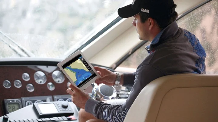
B&G App updated with New Features
B&G®, the world’s leading sailing navigation, and instrument specialist unveiled its B&G App last summer and has followed up with a new release with updates offering a range of safety and navigation enhancements, personalized notifications plus the anchor alert safety feature for premium subscribers.
The B&G App is available on both the Apple Store for iOS and Google Play for Android and now offers satellite overlay view for premium subscribers, enhancing situational awareness with the option to choose between full view or land-only. In addition, sailors can select the transparency level of the layer.
Another popular update for sailors is the weather overlay on the charts which includes key data such as wind, gust, precipitation, air temperature, and pressure. During route planning, users can see what weather is predicted at a specific time and location during the route, opting for the weather overlay both from main charts or during route creation.
When anchoring, premium users can simply set their location and receive push notifications if their yacht is drifting, while they’re busy or sleeping on the boat. Using GPS data, a breach of the geofence will result in the sound of the alarm, meaning sailors can now be certain their anchor is not dragging and get a good night’s sleep.

Sailors will also appreciate the new social capabilities including sharing tracks with friends and followers in other applications (i.e. Facebook, WhatsApp, Text), sending and receiving referral invitations to the app, and push notifications for key events like weather-related alerts. Notifications are customizable by category within the settings.
The B&G App is free to download and offers free up-to-date and detailed nautical charts from C-MAP®, personal waypoints, routes and tracks, the latest marine weather, personalization, and much more.
The C-MAP charts on the app are carefully designed to highlight what is most important at any given time during your sailing experience, maintaining accuracy and a clean, uncluttered view. Charts are powered by data from official hydrographic offices with data continuously updated and augmented from thousands of data sources provides clarity and detail needed for your routing, whether that’s a voyage, race, or a few quick hours sailing with friends on the water.
Updates for all users:
- Personalised Notifications (by category)
- Sharing Tracks
- Referral & Invitation Capabilities
Premium Updates:
- Satellite Overlay View
- Weather Overlay
- Anchoring Alert
For further information you may contact the Official Distributor and Support Center for Greece:
Aegean Electronics SA
4 Zosimadon Str, Piraeus 185 31, Greece
Tel: +30 210 4123000
Recent Posts
- Simrad released s.v.24.12 for TV80
- HERTZ Marine introduces HMC NMEA2K
- Reduce fuel consumption and emissions
- Simrad released s.v.25.2 for CP60, ES80 & EQ50
- New software update for Anschütz SYNAPSIS NX
- ShipModul released firmware V3.34.0 for MiniPlex-3
- HERTZ Marine introduces CAPRI HBB
- Kahlenberg Air Horns in custom colors!
- OLEX releases version 17.6
- SEA.AI releases latest s.v.3.10
- JMC products comply with new BAM standards
- FarSounder adds whale and trash report feature
- SAILOR 6110 GMDSS, the only printer-less mini-C system
- OLEX releases version 17.5
Archives
- June 2025
- May 2025
- April 2025
- March 2025
- February 2025
- January 2025
- December 2024
- November 2024
- October 2024
- September 2024
- August 2024
- July 2024
- June 2024
- May 2024
- April 2024
- March 2024
- February 2024
- January 2024
- December 2023
- November 2023
- October 2023
- September 2023
- August 2023
- July 2023
- June 2023
- May 2023
- April 2023
- March 2023
- February 2023
- January 2023
- December 2022
- November 2022
- October 2022
- September 2022
- August 2022
- July 2022
- June 2022
- May 2022
- April 2022
- March 2022
- February 2022
- January 2022
- December 2021
- November 2021
- October 2021
- September 2021
- August 2021
- July 2021
- June 2021
- May 2021
- April 2021
- March 2021
- February 2021
- January 2021
- December 2020
- November 2020
- October 2020
- September 2020
- August 2020
- July 2020
- June 2020
- May 2020
- April 2020
- March 2020
- February 2020
- January 2020
- December 2019
- November 2019
- October 2019
- September 2019
- July 2019
- June 2019
- April 2019
- March 2019
- February 2019
- January 2019
- December 2018
- November 2018
- October 2018
- September 2018
- July 2018
- June 2018
- May 2018
- April 2018
- March 2018
- February 2018
- January 2018
- December 2017
- October 2017
- February 2017
- January 2017
- April 2016