OLEX 14.0 is available!
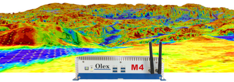
Norwegian based OLEX AS, the manufacturer of complete systems for navigation, plotting and 3D seafloor mapping, is pleased to announce that OLEX 14.0 was released and is available as a free download or through your local OLEX dealer for an upgrade of your system. Changes leading to OLEX 14.0 are mainly focused on navigation plotting improvements, interfacing refinements with various external systems and enhanced information on data handling plus various bug fixes on SL7, Wi-Fi, etc.

So a short-list of the latest release notes leading to OLEX 14.0 is:
– Better time filtering of plotter objects
– Optional password for file handling
– Shows which NMEA sentences are being sent where, through port 16700
– Better ergonomics when adjusting the plot layers for an object
– Adjustable life span for special targets from TLL, WPL and such
– Plotter object time grouping also applies to past trips.
– Own ship and vectors can be set to shimmer.
– New time grouping of plotter objects
– Screen decluttering: various onscreen panes can be collapsed
– Hardness from Furuno echosounders like FCV-295
– Speed filtering of AIS tracking
– Signal quality filtering of Subsonus Tags
– Supports Subsonus with heading from own ship
– Supports Subsonus from Advanced Navigation
– Supports ChartWorld C-MAP
– Updated NGU Marine maps
– Drawing functions: Line segment length, rotation of group
– Minor: AIS timeouts, AIS targets, Subsonus running time, no Subsonus HDT
– Minor: Import timestamp for Internet plotter objects
– Minor: Various adjustments after PME.
– Minor: AIS flags, Subsonus, depth contours,
– Minor: Detection of ANPP vs NMEA
– Minor: Cosmetic adjustments for Subsonus, error reporting
– Bug fixes: Undefined mouse buttons, period selector, VTG
– Bug fixes: AIS, Subsonus, ANPP
– Bug fixes: SL7 autoupdate, SL7 timezone, AIS without own MMSI
– Bug fixes: WiFi, satellite graph
– Bug fixes: Own ship AIS, WiFi selector flash
After years of research, development, and testing, OLEX AS has developed and keeps refining the most comprehensive seafloor topography mapping system available on the market. OLEX systems are based on Linux, and are considered to be the most stable systems of their kind available on the commercial market. Speed, flexibility, and user-friendliness are important keywords to explain their success.
OLEX can use official and unofficial vector charts, in S57, shape and SOSI format, from Hydrographic Offices and commercial vendors. The navigation charts are displayed alongside the collected seabed data and the chart visualization software will always strive to achieve a clear and informative chart image and prevent the screen from filling up with unnecessary information, by displaying only information relevant to the current zoom scale. Zooming and chart display are fast, easy and seamless.
For further information you may contact the Official Distributor and Support Center for Greece and Cyprus:
Aegean Electronics SA
4 Zosimadon Str, Piraeus 185 31, Greece
Tel: +30 210 4123000
E-mail: info@aegeanel.com
Recent Posts
- Simrad released s.v.24.12 for TV80
- HERTZ Marine introduces HMC NMEA2K
- Reduce fuel consumption and emissions
- Simrad released s.v.25.2 for CP60, ES80 & EQ50
- New software update for Anschütz SYNAPSIS NX
- ShipModul released firmware V3.34.0 for MiniPlex-3
- HERTZ Marine introduces CAPRI HBB
- Kahlenberg Air Horns in custom colors!
- OLEX releases version 17.6
- SEA.AI releases latest s.v.3.10
- JMC products comply with new BAM standards
- FarSounder adds whale and trash report feature
- SAILOR 6110 GMDSS, the only printer-less mini-C system
- OLEX releases version 17.5
Archives
- June 2025
- May 2025
- April 2025
- March 2025
- February 2025
- January 2025
- December 2024
- November 2024
- October 2024
- September 2024
- August 2024
- July 2024
- June 2024
- May 2024
- April 2024
- March 2024
- February 2024
- January 2024
- December 2023
- November 2023
- October 2023
- September 2023
- August 2023
- July 2023
- June 2023
- May 2023
- April 2023
- March 2023
- February 2023
- January 2023
- December 2022
- November 2022
- October 2022
- September 2022
- August 2022
- July 2022
- June 2022
- May 2022
- April 2022
- March 2022
- February 2022
- January 2022
- December 2021
- November 2021
- October 2021
- September 2021
- August 2021
- July 2021
- June 2021
- May 2021
- April 2021
- March 2021
- February 2021
- January 2021
- December 2020
- November 2020
- October 2020
- September 2020
- August 2020
- July 2020
- June 2020
- May 2020
- April 2020
- March 2020
- February 2020
- January 2020
- December 2019
- November 2019
- October 2019
- September 2019
- July 2019
- June 2019
- April 2019
- March 2019
- February 2019
- January 2019
- December 2018
- November 2018
- October 2018
- September 2018
- July 2018
- June 2018
- May 2018
- April 2018
- March 2018
- February 2018
- January 2018
- December 2017
- October 2017
- March 2017